
Buoyage – seamarks, buoys and lights explained
Seamarks, buoys, beacons, perches and lights are together known as buoyage. In Denmark the buoyage follows the international IALA system, region A. Here is the full overview: what the marks mean, how to recognise them by colour, shape, topmark and light – and which side to keep them on.
Practise the seamarks on a real nautical chart →What is a seamark?
A seamark is any fixed or floating mark that helps you navigate safely. The words are used somewhat loosely, but they all describe the same system:
- Buoy – a floating mark, moored to the seabed. It can be conical, can (cylindrical), spherical, pillar-shaped or a spar buoy.
- Beacon – a fixed mark, typically a pole or tower on land or on a shoal.
- Perch, pole and withy – simple fixed marks; the withy (a perch topped with twigs or a broom) is used especially in shallow channels and fjords.
- Light – a fixed mark with a light, from small leading lights to large coastal lighthouses.
Whether it is a buoy or a beacon, it is the colour, the shape, the topmark and, at night, the light characteristic that tell you what the mark means.
Direction of buoyage – when are you "inbound"?
Lateral marks are laid out in a fixed direction of buoyage: you count as inbound when sailing from the sea towards a harbour, fjord or river mouth. In open waters a fixed, general direction applies. In Danish waters the general inbound direction is, roughly speaking, southbound – from the Kattegat down through the Belts and the Øresund towards the Baltic.
If you sail the opposite way (outbound), the sides are swapped: green marks are then kept to port and red marks to starboard.
Lateral marks – green and red

Green lateral mark: green conical buoy with a green cone topmark 
Red lateral mark: red can buoy with a red cylinder topmark
Lateral marks show the edges of a channel. In IALA region A:
- Green lateral marks are kept to starboard when inbound. The shape is conical, and the topmark a green cone pointing upwards.
- Red lateral marks are kept to port when inbound. The shape is can (cylindrical), and the topmark a red cylinder.
The light has the same colour as the mark and may have any rhythm – e.g. Fl.G.3s or Fl(2)R.6s. Many lateral marks are numbered: green with odd and red with even numbers.
Preferred channel mark – where the channel divides

Green preferred channel mark: green buoy with a red horizontal band 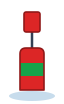
Red preferred channel mark: red buoy with a green horizontal band
Where a channel divides in two, a preferred channel mark shows which one is the main channel. The mark has the colour of the side the main channel should be kept to, with a broad horizontal band in the other colour.
- Green with a red band: the main channel continues to port – keep the mark to starboard, just like a green lateral mark.
- Red with a green band: the main channel continues to starboard – keep the mark to port, just like a red lateral mark.
The light is typically a composite group, e.g. Fl(2+1)G or Fl(2+1)R.
Cardinal marks – north, east, south and west

North cardinal mark: black over yellow, two cones pointing up 
East cardinal mark: black-yellow-black, two cones base to base 
South cardinal mark: yellow over black, two cones pointing down 
West cardinal mark: yellow-black-yellow, two cones point to point
A cardinal mark tells you on which side of a danger the safe water lies. The name gives the side to pass on: a north cardinal stands north of the danger, and you pass north of it. The marks are always black and yellow, and the two black cones on top are the key memory aid – the cones point to the black sections.
| Mark | Topmark | Colours | Light (white) |
|---|---|---|---|
| North | Two cones, points up | Black over yellow | Q or VQ – continuous |
| East | Two cones base to base | Black-yellow-black | Q(3)10s / VQ(3)5s |
| South | Two cones, points down | Yellow over black | Q(6)+LFl.15s / VQ(6)+LFl.10s |
| West | Two cones point to point | Yellow-black-yellow | Q(9)15s / VQ(9)10s |
The number of flashes follows a clock face: 3 (3 o'clock = east), 6 (south) and 9 (west). The long flash after the south mark's six short ones makes it easy to tell apart from west and east.
Isolated danger mark

Isolated danger mark: black with a red horizontal band and two black spheres as topmark
Placed on – or right next to – a small, isolated danger with navigable water all around, e.g. a single rock or a wreck. The mark is black with one or more broad red bands and has two black spheres one above the other as its topmark. The light is white, two flashes: Fl(2)5s. Keep well clear – you may pass on any side, but not close.
Safe water mark (landfall buoy)

Safe water mark: red and white striped buoy with a single red sphere topmark
Indicates that there is navigable water all around – typically in the middle of a channel or as a landfall mark for a harbour or channel. The mark has vertical red and white stripes and a single red sphere as its topmark. The light is white with a calm rhythm, e.g. isophase Iso, a long flash LFl.10s or Morse "A" Mo(A).
Special marks and wreck marks

Special mark: yellow buoy with a yellow cross topmark 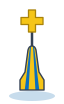
Wreck mark: blue and yellow striped buoy with an upright yellow cross
Special marks are yellow with a yellow cross (X) topmark and are used for anything that is not a navigational hazard in itself: racing courses, firing ranges, cables and pipelines, fish farms, measuring instruments and the like. The light is yellow, e.g. Fl.Y or Fl(4)Y. Check the nautical chart to see what that particular mark indicates.
Wreck marks (emergency wreck marking buoys) are blue and yellow striped with an upright yellow cross and a flashing blue and yellow light. They are used temporarily until a new wreck has been marked in the normal way.
Lights and light characteristics
Light
At night you recognise the marks by their light – the colour and the light characteristic (the rhythm). The characteristic is given in the nautical chart and the list of lights as a short code:
| Code | Meaning |
|---|---|
F | Fixed light – shines continuously |
Fl | Flash – the light is on for less time than it is off |
LFl | Long flash – at least 2 seconds |
Q / VQ | Quick flashing (about 60 per minute) / very quick flashing (about 120 per minute) |
Iso | Isophase – equal periods of light and dark |
Oc | Occulting – the light is on for longer than it is off |
Mo(A) | Morse – the light flashes a Morse letter |
(3), 10s | Number of flashes in the group and the period in seconds |
W R G Y | White, red, green and yellow |
Many lights are sector lights: white in the safe sector and red or green to the sides. How far you can see a light depends on both its intensity (luminous range) and its height – the geographical range is about 2.08 · (√light height + √eye height) nautical miles.
Mooring buoys

Mooring buoy: yellow spherical buoy marked DT
The yellow mooring buoys marked "DT" are not navigation marks but moorings that sailors may use free of charge – typically for one day at a time. On the nautical chart you can see every mooring buoy with its name and position.
Practise the seamarks interactively
Read about the marks – then practise them. On Seamarks you pick a type and see every mark of that kind highlighted on a real nautical chart around Samsø and Sejerø. Click a mark to see its colour, shape, topmark and a light flashing in the right rhythm. Want to learn ships' lights too? Try navigation lights in 3D.
Frequently asked questions
Which side should the green buoy be kept on?
In IALA region A (Europe, including Denmark) the green lateral mark is kept to starboard when you sail in the direction of buoyage (inbound). When outbound, keep it to port.
What is the difference between a buoy and a beacon?
A buoy is a floating mark moored to the seabed. A beacon is a fixed mark, such as a pole or a tower. Both follow the same colours and topmarks.
How do you recognise a cardinal mark?
It is black and yellow with two black cones on top. North: points up. South: points down. East: base to base. West: point to point. You pass on the side the mark is named after.
What does Q(6)+LFl.15s mean?
Six quick flashes followed by one long flash, repeated every 15 seconds. It is the light characteristic of a south cardinal mark.
What is IALA region A?
IALA is the international buoyage system. Region A is used in Europe, Africa and most of Asia and Oceania: red to port and green to starboard when inbound. In region B (North and South America, among others) the colours are reversed.
What does a yellow buoy with a cross mean?
It is a special mark. It indicates, for example, racing courses, firing ranges, cables or fish farms – not a navigational hazard. The nautical chart shows what that particular mark indicates.